
Nowtica
Coves, anchorages and the hop to the Balearics: the sailing guide to the coast from València to Alicante
From Les Rotes to Tabarca: coves, anchorages, marine reserves and the crossing to Ibiza — a reference guide to Spain’s most complete 90 miles of coastline.
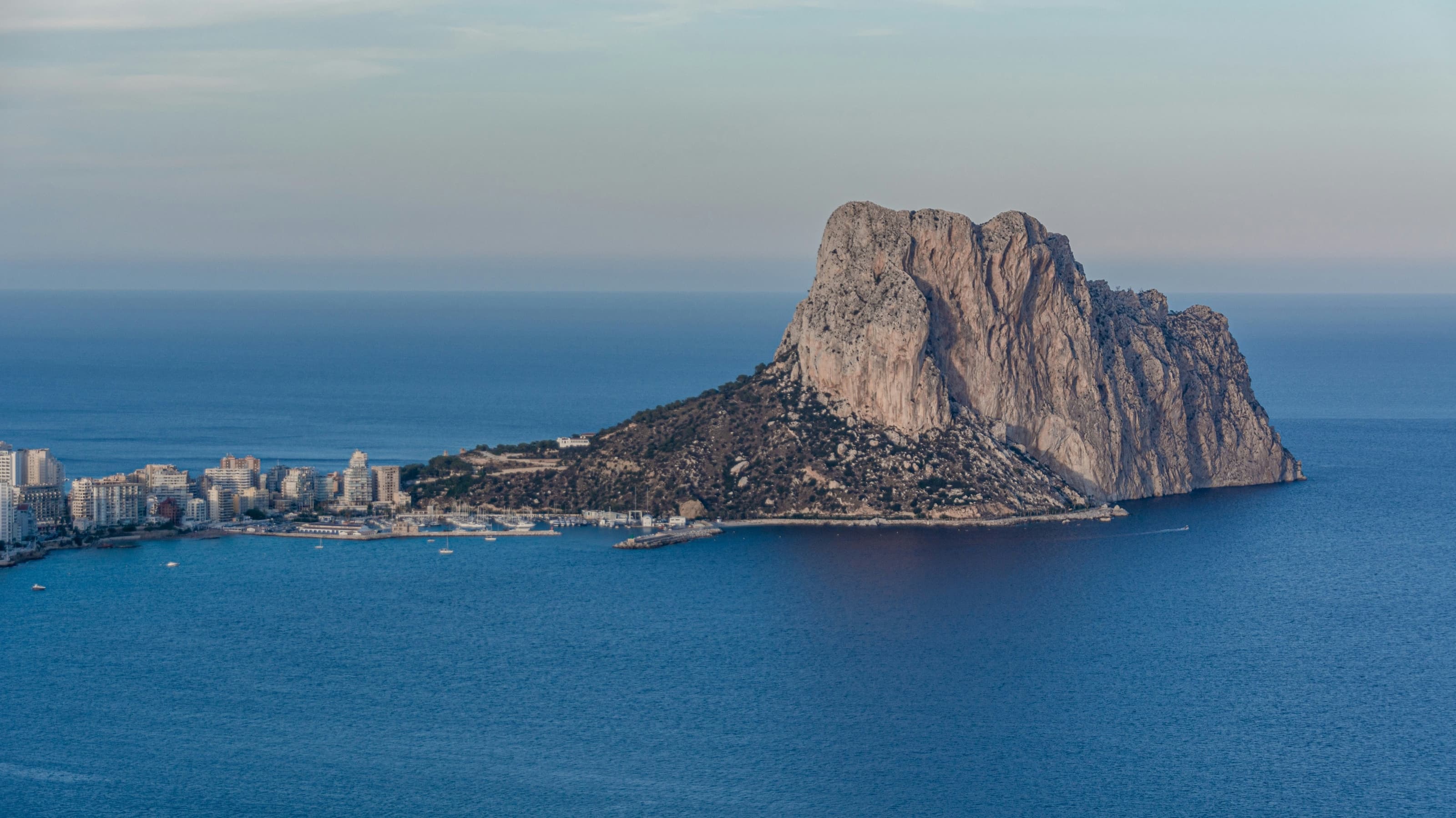
The Penyal d’Ifac presides over Calp’s twin bays, halfway down the coast.
Few stretches of the Spanish Mediterranean pack so much sailing variety into so few miles as the coast between València and Alicante. In barely 90 miles of coastal passage, the sailor goes from the long sandy beaches of the Gulf of València to the cliffs of Cabo de San Antonio and Cabo de la Nao, the sheltered coves of Xàbia and Moraira, the unmistakable silhouette of the Peñón de Ifach, the bay of Altea, the Serra Gelada natural park and, to crown it all, the only inhabited island in the Comunitat: Tabarca, Spain’s first marine reserve.
Add to this a unique strategic advantage: this stretch of coast is the natural gateway to the Balearics. From Dénia or Xàbia, Ibiza is one day’s sail away, which makes the Marina Alta the favourite base of operations for thousands of sailors every summer. This guide runs down the coast from north to south, cove by cove and anchorage by anchorage, with the practical information a skipper needs: shelter by wind direction, type of seabed, environmental restrictions, ports of refuge and the planning of the crossing to the Balearics.
Important notice: this guide is for orientation only. The depths and conditions described are approximate and may vary. Always consult up-to-date nautical charts, official weather bulletins and the regulations in force before planning any passage.
How to sail this coast
Summer is ruled by the thermal-breeze cycle: morning calm, a sea breeze filling in towards midday at 10 to 18 knots, and a drop at sunset. It is a very forgiving pattern for afternoon sailing and for planning morning anchorages in east-facing coves. The winds that demand respect are different ones:
- Llevant (E-NE): the wind that raises the heaviest seas on this coast. In a fresh easterly, most east-facing coves — Granadella, Portitxol, El Portet — become uncomfortable or downright dangerous. Levante gales, more frequent in spring and autumn, close down the coast.
- Ponent (O): an offshore land wind, dry and gusty. It leaves flat water close inshore but can surprise with strong gusts in the lee of the high ground, especially when passing the capes.
- The effect of the capes: Cabo de San Antonio and Cabo de la Nao accelerate the wind noticeably and generate confused seas nearby. They are the weather turning point of this coast: conditions often change appreciably once you round the Nao.
For practical purposes the coast divides into four big zones: the Gulf of València (València–Dénia), low and sandy, with hardly any natural shelter outside the ports; the Marina Alta (Dénia–Moraira), the star stretch, with cliffs, deep coves, two marine reserves and the highest density of quality anchorages; the Marina Baixa (Calp–Villajoyosa), with the wide bays of Altea and Benidorm and the Serra Gelada natural park; and the Alacantí with Tabarca, from the urban coves of Cabo de las Huertas to the island’s marine reserve.
Safety and communications: permanent watch on VHF channel 16, and the Spanish Maritime Rescue number, 900 202 202, always to hand. In summer there is heavy leisure traffic, jet skis, ferries to the Balearics and excursion boats: maximum vigilance off the harbour mouths of Dénia, Calp, Benidorm and Alicante.
Rule number one: the posidonia
Before running through the coves, the rule every sailor must internalise on this coast: anchoring on Posidonia oceanica meadows is forbidden. They are a priority habitat protected by the European Habitats Directive and the key to the transparency of these waters. In the Comunitat Valenciana the ban has been explicit since Decree 64/2022, which outlaws anchoring on the meadows and whose official mapping can be checked in the public app GVA Fondea; Law 3/2025, on the protection and planning of the Valencian coast, has further reinforced that framework.
- Anchor only on sand. Sand shows as pale patches; posidonia as dark ones. In good light and clear water you can tell them apart by eye; if in doubt, check the bottom before letting go the anchor.
- The penalties are very serious. In an operation by the Guardia Civil’s maritime service in Xàbia (summer 2025), eleven reports were filed, four of them for anchoring on posidonia; damaging the habitat is a serious offence under the Natural Heritage Act, with fines from €3,001 up to €200,000. Surveillance tightens every season, and in Moraira the local press has documented dozens of boats damaging the meadow daily.
- Eco-moorings on the rise. The most recent case is Calp, which in July 2026 completed the installation of 20 ecological moorings: 10 off Cantal Roig beach — where they protect Cymodocea meadows — and 10 in Cala del Penyal, south of La Fossa beach, over posidonia. In the marine reserves (Cabo de San Antonio, Tabarca) free anchoring is forbidden.
Sand yes, posidonia never; and where there are buoys, buoy before anchor.
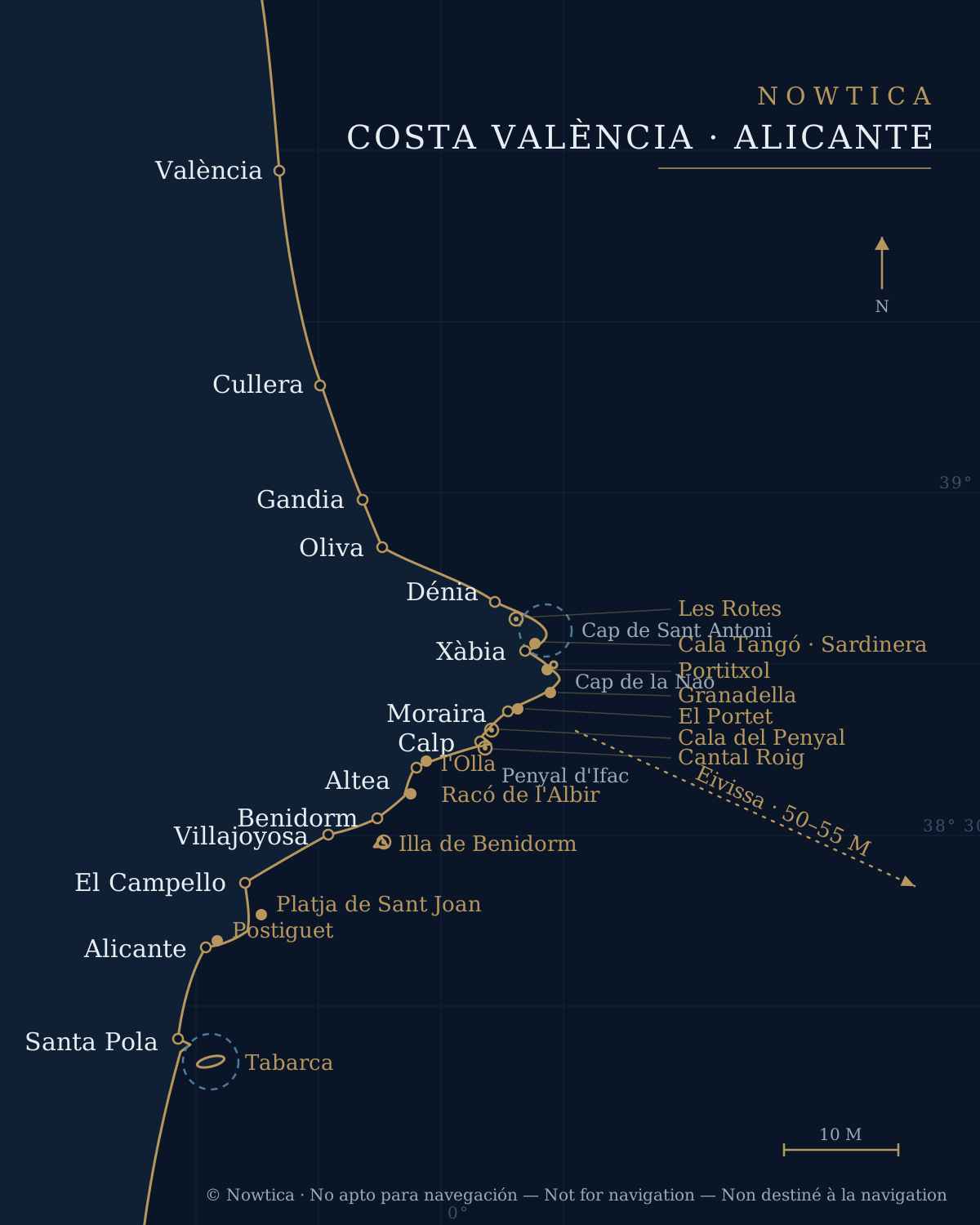
The coast at a glance. Solid dot: sand anchorage · ring: eco-mooring buoy field · dashed circle: marine reserve · “M”: nautical miles. Illustration for orientation only, not for navigation.
Photo: © Nowtica
From València to Dénia: the gulf
Leaving the Marina de València southbound, the coast is a succession of open beaches: El Saler, the Devesa de l’Albufera, Cullera, Tavernes, Gandia and Oliva. It is easy sailing but with little natural protection: anchorages are off the beach, on sand, and only viable in settled weather with westerly winds or calms.
- Cullera: the Cullera cape and its lighthouse are the only significant rocky feature of the stretch and give some shelter from the north on their south side. Cullera prides itself on having the only cove in the province of València (the Cala del Far), and the mouth of the Júcar adds scenic interest. A river marina lies in the river itself.
- Gandia: a major port with a yacht club west of the entrance; anchoring is possible off Venecia beach in light breezes.
- Oliva: kilometre-long beaches with a gently shelving sandy bottom. Watch for sandbanks near the river mouths.
This stretch is often sailed in one go — València–Dénia is some 50 miles — by anyone heading for the Marina Alta or the Balearics, but it deserves a quiet stopover out of season.
Dénia and the Cabo de San Antonio reserve
Dénia is the sailing capital of this stretch, with four facilities: the fishing-and-commercial port with its ferry terminal — from which Baleària’s ferries leave for Ibiza and Formentera —, the Real Club Náutico de Dénia, Marina de Dénia and Marina El Portet. Full visitor services, a boatyard, and the classic base for hopping to the Balearics and exploring the Marina Alta. South of the port, the Les Rotes shore strings together small pebble-and-rock coves until it dies at the cliffs of Cabo de San Antonio, which separates Dénia from Xàbia.
The waters around the cape are the Cabo de San Antonio Marine Reserve of Fishing Interest, one of the best-preserved marine spaces in the Comunitat. For the sailor, the essential rules:
- Anchoring is forbidden inside the reserve: only mooring to the authorised buoys is allowed. The field is very small — 7 buoys off the Les Rotes shore, between Punta Negra and the Torre del Jarro — so in season it pays to arrive early.
- Maximum speed 6 knots inside the reserve.
- Jet skis forbidden in the fishing-interest reserve.
- Recreational fishing forbidden in all its forms: from shore, from a boat and underwater.
- Diving only with prior authorisation from the Generalitat (approved dive centres handle it directly). Any discharge and the removal of marine organisms are forbidden.
The reward for playing by the rules: water of Balearic clarity, spectacular snorkelling grounds along the authorised edges and frequent dolphin sightings nearby.
Xàbia: the jewel of the anchorages
Once round Cabo de San Antonio, the bay of Xàbia opens up — probably the finest set of anchorages on the whole Valencian coast. From north to south:
- Cala Tangó y La Sardinera: tucked under the south face of Cabo de San Antonio, well sheltered from north and north-west winds, over a mixed bottom of sand and rock. La Sardinera is the classic last stop before rounding the cape back to Dénia.
- Xàbia bay and harbour: the Club Náutico de Jávea’s harbour is small but handy for short stays. The bight off La Grava beach and the Arenal allows anchoring on sand in 4–8 metres in settled weather; mind the buoyed bathing areas in summer.
- Portitxol / La Barraca: the icon. The cove, presided over by Portitxol island and its blue-doored fishermen’s huts, offers a roomy anchorage in 3–10 metres. The bottom alternates sand with extensive posidonia beds: here it is essential to pick a sand patch — perfectly visible — or arrive early. Sheltered from west and north-west; uncomfortable in easterlies and southerlies. This is the area with the most reports for anchoring on posidonia: take extreme care.
- Ambolo y Cap Negre: between the Portitxol and Cabo de la Nao, imposing cliffs with day anchorages sheltered from the north, beneath the Descubridor islet. Deep water very close to the shore.
- Cala Granadella: repeatedly voted among the best coves in Spain. Small, hemmed in, facing east, with turquoise water over sand and rock in 4–10 metres. In August, either you arrive first thing or you find the cove full. Good shelter from north and south thanks to the cliffs; open to the east.
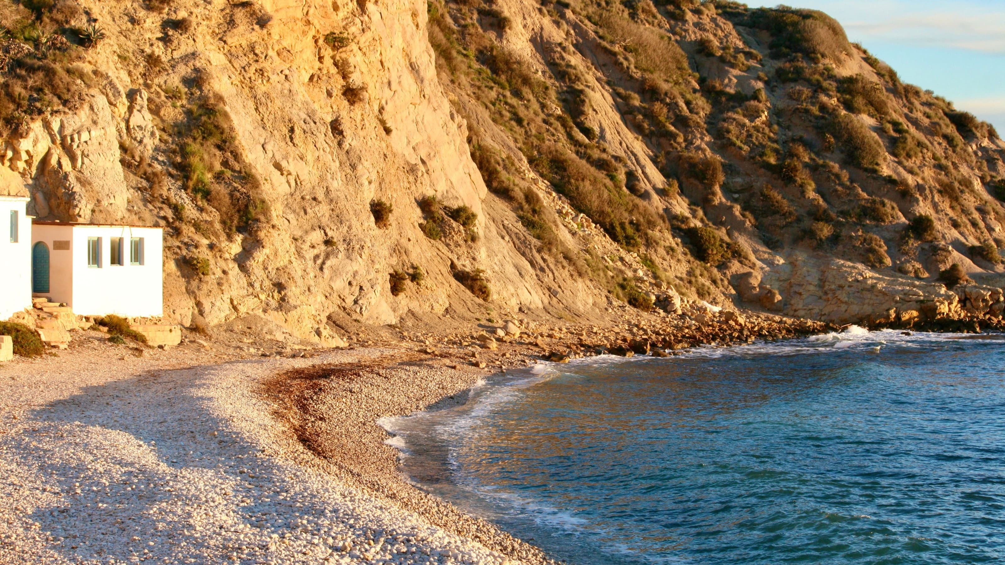
The Portitxol fisherman’s hut, the icon of the Xàbia shore.
Photo: Foto: Holly Jean / Pexels
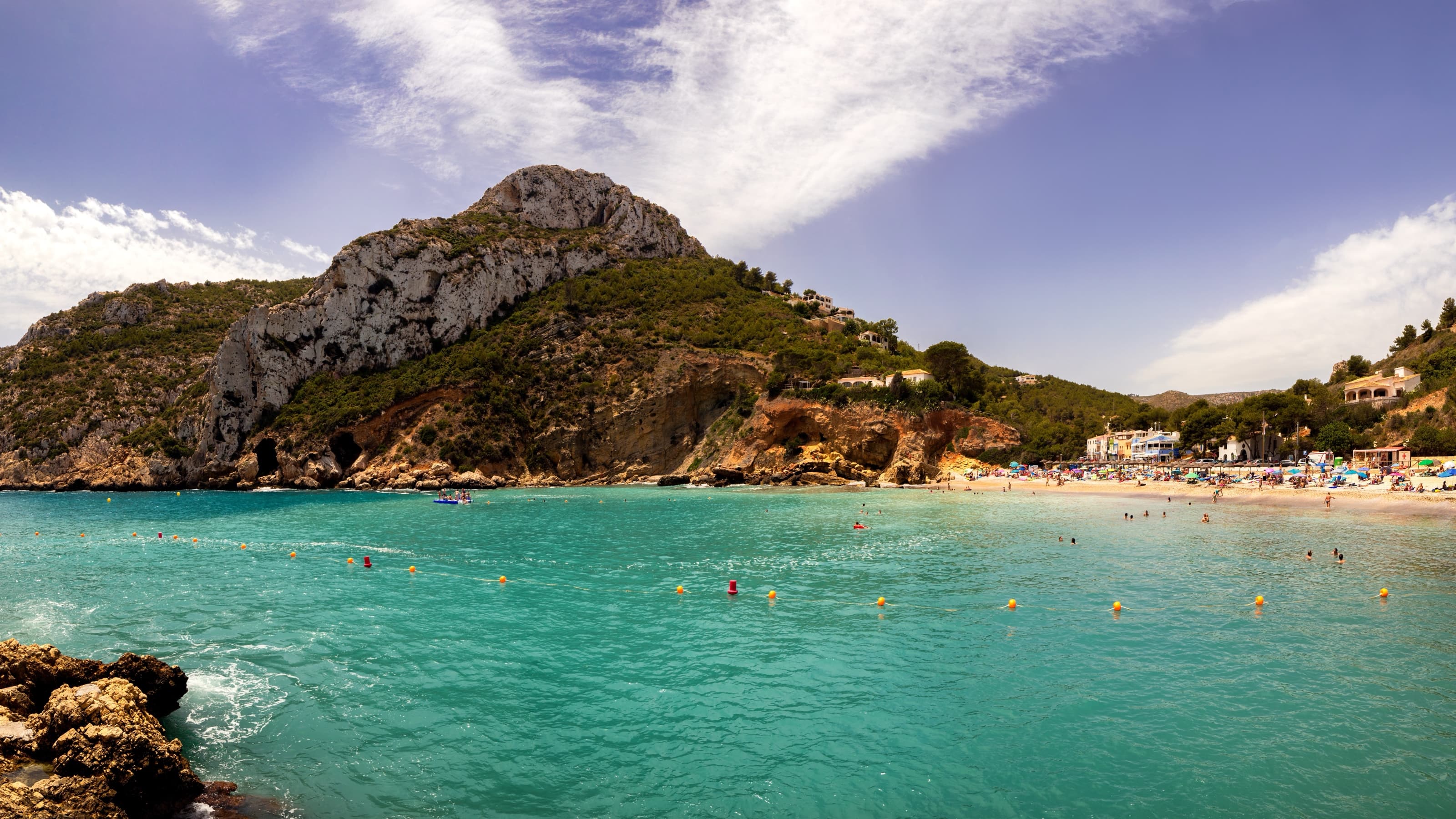
La Granadella, repeatedly voted among Spain’s best coves.
And at the end, Cabo de la Nao: the easternmost point of the Comunitat and the great landmark of this coast. It accelerates the wind, stirs up cross seas and marks the change in the shoreline’s orientation; in fresh north-easterlies, rounding it can be the most demanding moment of the passage. It is also the point of the Peninsula closest to Ibiza.
Benitatxell and Moraira
- Cala Moraig y Cala Llebeig: beneath the Benitatxell cliffs, with the impressive Moraig fault and the Cova dels Arcs. Day anchorages only in total calm: rock-and-sand bottoms, no real shelter. In exchange, one of the wildest landscapes on the coast.
- El Portet: the best holding in the area. A shell-shaped cove beneath the Cap d’Or, sheltered from west through north to north-east, sand bottom in 3–6 metres. A comfortable anchorage even overnight in stable weather. Beware: the bay holds substantial posidonia meadows and has been in the spotlight over damage from uncontrolled anchoring — always aim for the pale patches in the middle.
- L’Ampolla and l’Andragó: anchorages off Moraira’s main beach and the coves to the south, on sand and rock, next to the Club Náutico’s harbour.
- The Benissa shore: between Moraira and Calp, the coves of Baladrar, Advocat and Les Bassetes — with its small yacht club — offer pleasant day anchorages sheltered from the north-east.
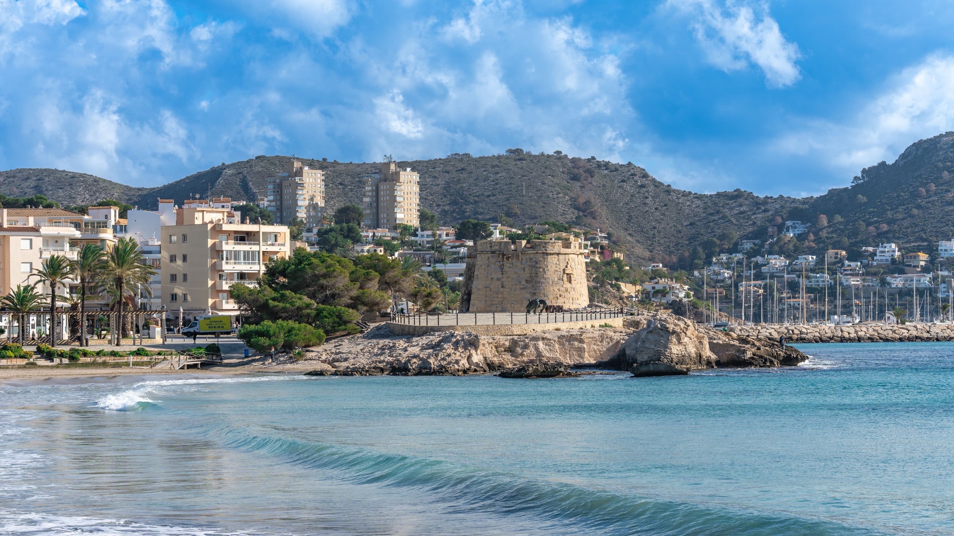
Moraira: the 18th-century castle and, behind it, the masts of the yacht club.
Calp and the Peñón de Ifach
The silhouette of the Penyal d’Ifac (332 metres), a natural park, presides over a double bay. North of the Rock lie La Fossa beach and Cala del Penyal, where in July 2026 the town council installed ten eco-mooring buoys over the posidonia meadow, sheltered from the south-west. To the south, the Arenal-Bol beach and Cantal Roig, with another ten buoys next to the harbour mouth, sheltered from north and north-east. The Rock’s immediate surroundings are protected: go slowly, do not anchor close under the rock, and use the buoys whenever possible.
Calp’s roadstead is also the traditional waiting anchorage for boats arriving from the Balearics or heading south. Between Calp and Altea you pass the narrow scenery of the Morro de Toix and the Mascarat, with rock walls dropping into the sea and small coves for day anchoring in calm weather.
Altea and its bay
The bay of Altea, protected from the north by the Sierra de Bèrnia and from the south by Serra Gelada, offers some of the noblest sailing water on this coast: steady breezes and generally manageable seas.
- Marina Greenwich (Campomanes): at the foot of the Mascarat, a modern, well-sheltered marina and a regular stop on coastal passages.
- Club Náutico de Altea and Portosenso: a wide choice of berths off Altea’s white old town, one of the most photogenic villages in the Mediterranean.
- L’Olla de Altea: the star anchorage of the bay, off l’Olla beach and its islet, sand with posidonia patches in 4–8 metres. Extremely busy in summer — and the stage for the famous August fireworks. Acceptable shelter from north and west.
- Cap Negret y la Illeta: secondary anchorages over rock and gravel, only in calm weather.
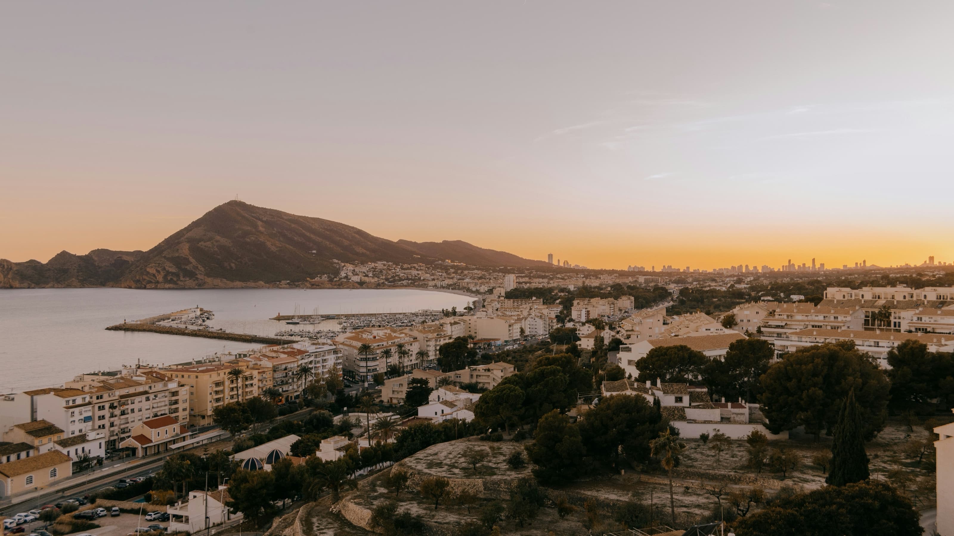
The bay of Altea at dusk: steady breezes and some of the noblest sailing water around.
Photo: Foto: Kenny / Unsplash
Benidorm, Serra Gelada and l’Albir
The Serra Gelada maritime-terrestrial natural park closes the bay of Altea to the south with 300-metre cliffs. On its north face, the l’Albir point and lighthouse shelter the Racó de l’Albir from the south, with interesting snorkelling grounds; it is natural-park water, so respect the buoyage and speed limits. Round the Les Caletes point and Benidorm’s twin beaches open up beneath the skyline.
- Benidorm Island: some 2 miles off the harbour, the emblematic anchorage of the Marina Baixa and a specially protected area within the natural park: within half a mile of the island’s lighthouse, mooring is on the designated buoys, with a 3-knot speed limit and diving by authorisation. Clear water and a lively summer scene of trip boats and divers: keep well clear of the passenger boats and the divers’ marks.
- Almadrava y Tio Ximo: small rocky coves at the foot of Serra Gelada, ideal for snorkelling in calm weather.
- Benidorm harbour: a small basin, mainly for excursion boats; comfortable visitor berths are in Altea or Villajoyosa.
- Villajoyosa and El Campello: Villajoyosa offers a harbour with a yacht club and, on its boundary with Benidorm, the Racó del Conill, a mixed-bottom cove much appreciated as a day anchorage. Then comes El Campello, with a marina and the Amerador cove, the gateway to Cabo de las Huertas.
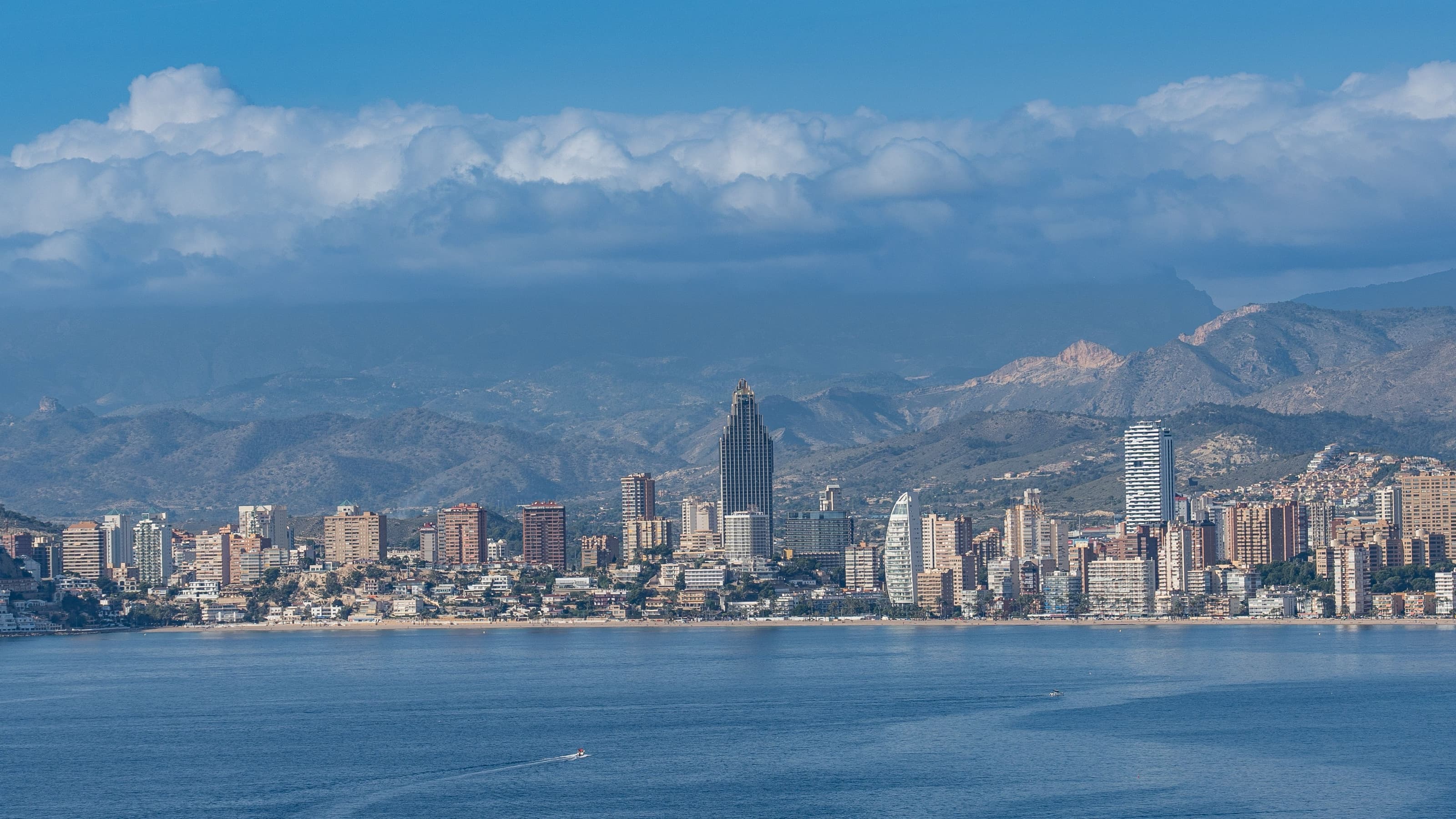
Benidorm from the water, with the Puig Campana behind.
Alicante: Cabo de las Huertas and the capital
Cabo de las Huertas separates Sant Joan beach from the bay of Alicante with a low rocky shore dotted with coves:
- San Juan beach: a roomy anchorage over clean sand in 6–10 metres, excellent in westerlies; easterly winds bring in a chop.
- Cala dels Cantalars y La Palmera: small, mixed-bottom coves, perfect for a morning’s snorkelling; room for one or two boats.
- Cala de la Almadraba: sand with posidonia patches in 4–7 metres: pick a clear sand pool.
- Postiguet beach: an urban anchorage beneath Santa Bárbara castle, in 5–8 metres; sheltered from westerlies, exposed to the east.
The city has serious berthing: Marina Alicante right in the centre, the Real Club de Regatas and boatyards. Alicante has also been the start port of The Ocean Race since 2008 — the 2027 edition will set off from here again — with a growing sailing culture and every service.
Tabarca: Spain’s first marine reserve
Some 8 miles south of Alicante and 3 from the Santa Pola cape, the island of Tabarca is the great day-trip destination of the southern coast. Its waters have been a Marine Reserve of Fishing Interest since 1986 — Spain’s first — regulated by Order APA/102/2019. And here it pays to be very clear, because the rules are stricter than many sailors believe:
- Anchoring is forbidden throughout the reserve since 2019, except in emergencies involving the safety of life at sea. There is no “authorised area” for the anchor: the existing mooring buoys are reserved for the authorised dive sites. The reserve holds one of the finest posidonia meadows in the peninsular Mediterranean.
- Transit between 6 and 10 knots: boats crossing the reserve must sail at more than 6 and less than 10 knots, keeping as far off the shore as possible.
- Fishing and collecting forbidden for recreation in all forms; only registered professional fishing and scientific work have authorisation channels. The Guardia Civil patrols with a severe penalty regime.
- Mind the passenger boats: in summer the tourist boats from Alicante and Santa Pola come and go constantly: respect the access channel and the divers’ signals.
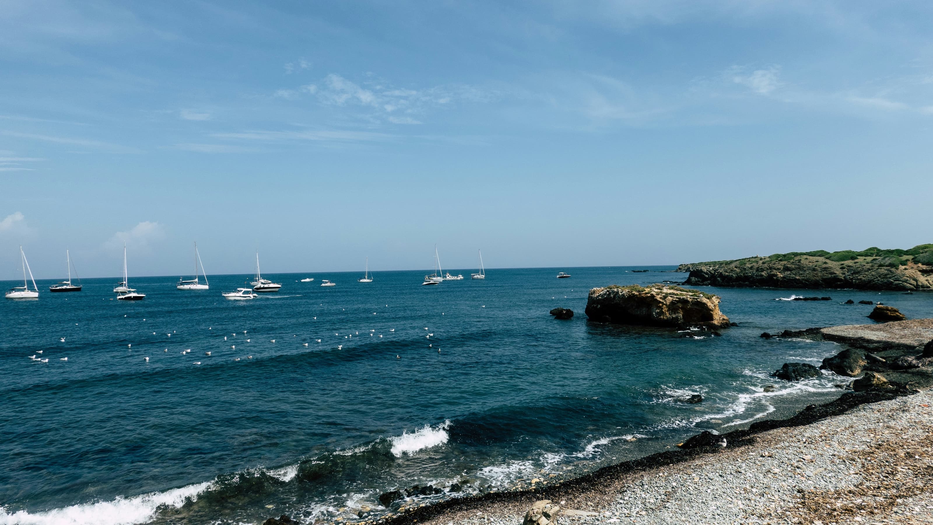
Sailboats off Tabarca: a scene now restricted — since 2019 anchoring inside the reserve is forbidden except in emergencies.
Photo: Foto: Will Myers / Unsplash
The reward makes up for the rigour: water with 20-metre visibility, a walled village — a former fortified outpost of Charles III — and the best caldero rice in the province. Today’s nautical visit is about respectful transit and a stop ashore; anyone looking to anchor will find their options further north, in the coves of Cabo de las Huertas, or among the Santa Pola anchorages outside the reserve’s limits.
Ports and visitor berths
| Port / Marina | Town | For visiting boats |
|---|---|---|
| Marina de València · RCN València | València | Big capacity, every service; the base for the Balearics hop from the north |
| Puerto de Cullera | Cullera | River basin in the Júcar, moderate lengths |
| RCN Gandia | Gandia | A good refuge halfway down the gulf |
| Puerto de Oliva | Oliva | A quiet stop; tight depths at the entrance |
| Dénia: Marina de Dénia · RCN Dénia · Marina El Portet | Dénia | The great hub: visitor berths, boatyard, ferries to the Balearics |
| CN Jávea | Xàbia | Small, central in the bay |
| CN Moraira | Teulada-Moraira | Very well kept, next to El Portet |
| Les Bassetes | Benissa | A minor facility, anchorages close by |
| Puerto de Calp (RCN Calpe) · Puerto Blanco | Calp | At the foot of the Rock; new eco-buoys in the coves |
| Marina Greenwich (Campomanes) | Altea | A modern, sheltered marina beneath the Mascarat |
| CN Altea · Portosenso | Altea | A wide offer in the bay |
| Puerto de Benidorm | Benidorm | Limited; passenger boats have priority |
| CN Villajoyosa | Villajoyosa | An authentic stop with a fishing-port feel |
| CN El Campello | El Campello | Handy before Cabo de las Huertas |
| Marina Alicante · RCR Alicante | Alicante | First-rate city-centre berthing |
| Puerto de Santa Pola · CN Santa Pola | Santa Pola | The ideal base for the Tabarca day trip |
The crossing to the Balearics: the natural hop
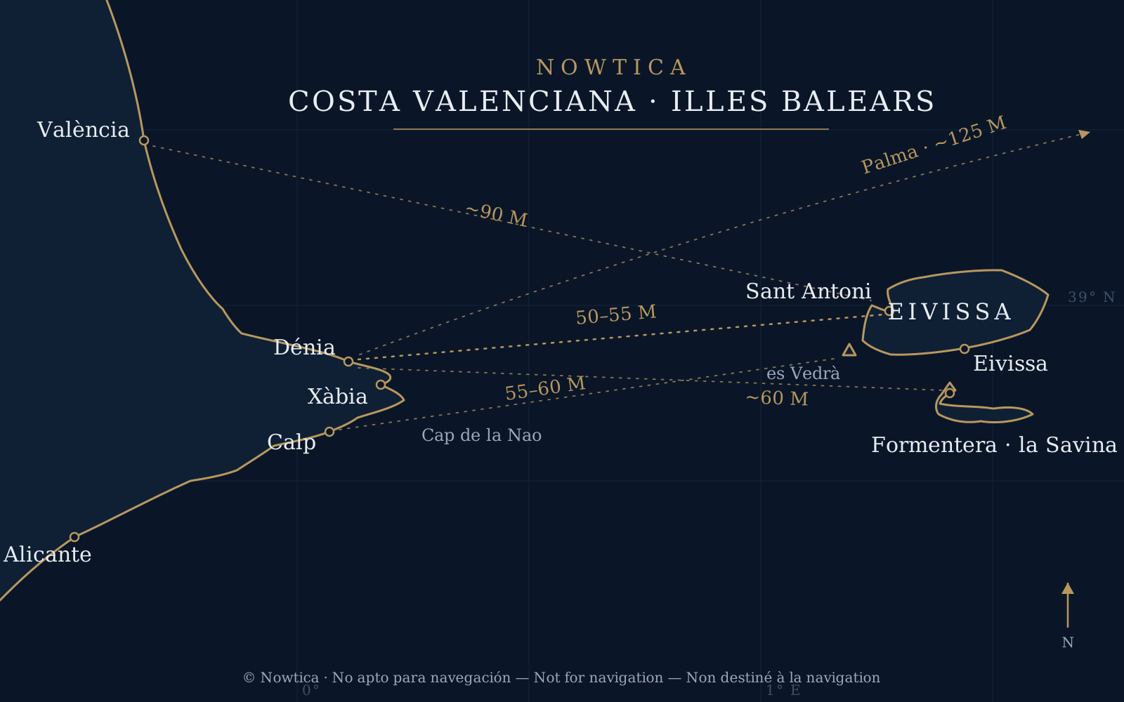
The classic routes across the Ibiza channel. “M”: nautical miles. Illustration for orientation only, not for navigation.
Photo: © Nowtica
The Marina Alta is the point of the Peninsula closest to Ibiza, and that defines the most popular route in the Spanish Mediterranean. The distances, with passage times for a sailing boat at 6–7 knots:
| Route | Approx. distance | Passage time (6–7 knots) |
|---|---|---|
| Dénia / Xàbia → Sant Antoni (Ibiza) | 50–55 NM | 8–10 h |
| Dénia → Eivissa (town, southabout) | ~65 NM | 10–12 h |
| Dénia → Formentera (la Savina) | ~60 NM | 9–11 h |
| Moraira / Calp → Ibiza (west coast) | 55–60 NM | 9–11 h |
| València → Ibiza / Sant Antoni | ~90 NM | 14–16 h |
| Dénia → Palma de Mallorca | ~125 NM | 20 h or more, or a stop in Ibiza |
- The weather window is everything. What matters is not the distance but wind and sea in the Ibiza channel. Avoid established fresh easterlies and westerlies; the best summer windows are thermal-breeze days with a rippled sea. Check the offshore and coastal bulletins with 48 hours’ margin.
- The classic dawn departure from Dénia or Xàbia, to reach Ibiza’s west coast in daylight — with es Vedrà as an unforgettable landmark. The earliest risers leave at night to pick up a spot at Cala Bassa or Comte by midday.
- Traffic: the route crosses the Dénia–Ibiza ferry lanes and merchant routes: keep a visual watch, and AIS is highly recommended.
- Gear: lifejackets and harnesses for night sailing, engine checks and fuel reserves by the rule of thirds, liferaft and EPIRB according to the boat’s certified sailing area.
- On arrival in the Balearics: posidonia meadows are strictly protected by Balearic Decree 25/2018, and anchoring is organised through PortsIB’s regulated buoy fields — Ses Salines on Ibiza, s’Espalmador and Caló de s’Oli on Formentera — with advance booking strongly recommended in season. The “sand yes, posidonia no” culture is applied there with maximum rigour.
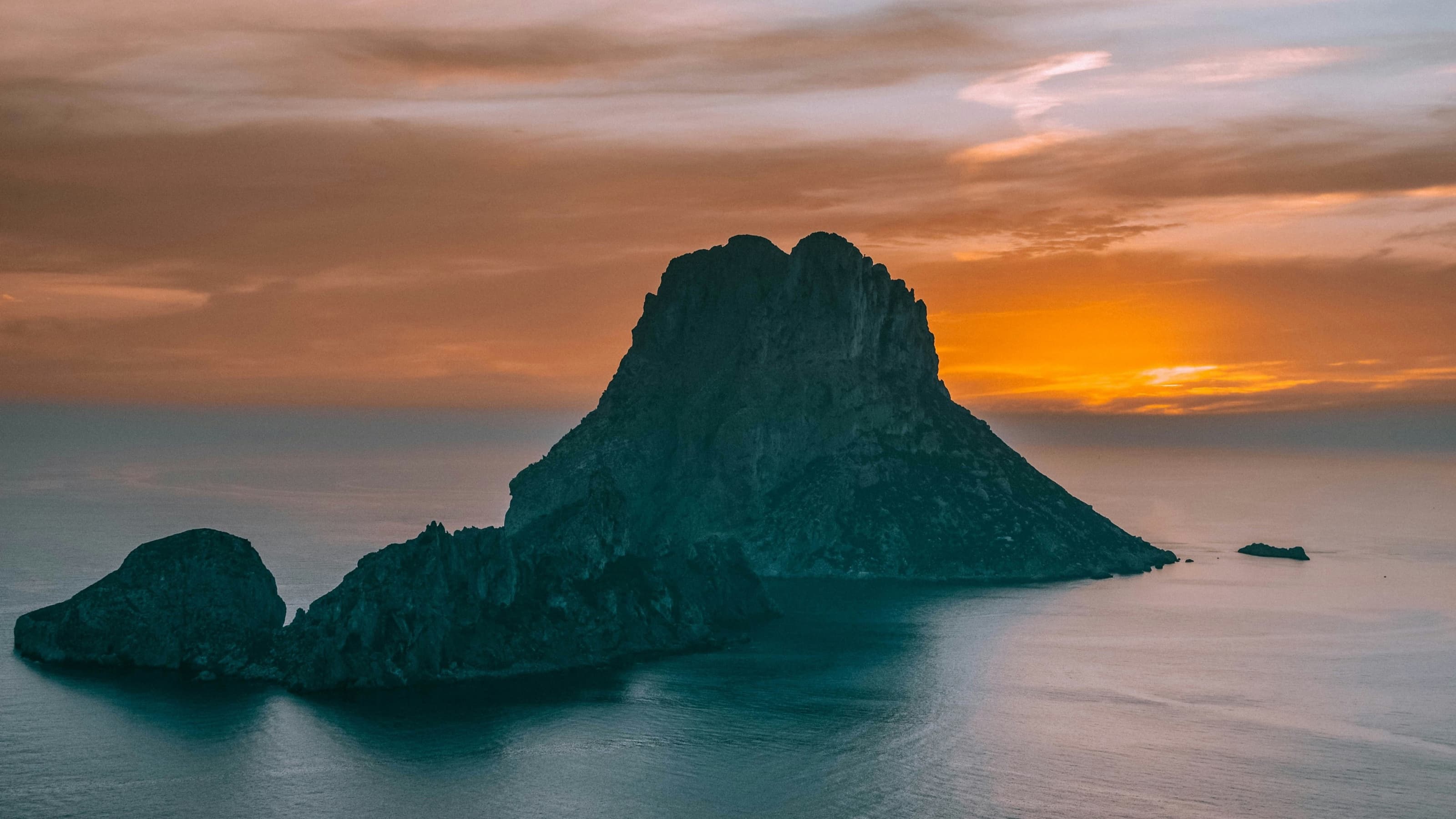
Es Vedrà, the unforgettable landfall mark of Ibiza’s west coast.
Photo: Foto: Bobby / Unsplash
The anchorages at a glance
| Anchorage | Area | Bottom | Shelter | Recommended use |
|---|---|---|---|---|
| Cabo de Cullera (S side) | Cullera | Sand | N | Day, settled weather |
| Les Rotes | Dénia | Rock and sand | NW-W | Day; buoy compulsory (7 available) |
| Cala Tangó / Sardinera | Xàbia | Sand and rock | N-NW | Day and night in stable weather |
| Xàbia bay (Arenal) | Xàbia | Sand | W | Day |
| Portitxol / La Barraca | Xàbia | Sand among posidonia | W-NW | Day; pick a sand patch |
| Granadella | Xàbia | Sand and rock | N and S | Day; arrive early |
| El Portet | Moraira | Sand | W-N-NE | Day and night; the best shelter of the stretch |
| L’Andragó / Baladrar / Advocat | Moraira-Benissa | Sand and rock | NE | Day |
| Cala del Penyal | Calp | Posidonia | SW | Day; eco-buoy |
| Cantal Roig | Calp | Sand and Cymodocea | N-NE | Day; eco-buoy |
| L’Olla de Altea | Altea | Sand and posidonia | N-W | Day and night in calm weather |
| Racó de l’Albir | L’Alfàs del Pi | Rock and gravel | S | Day |
| Benidorm Island | Benidorm | Sand and rock | Variable | Day; designated buoys, 3 knots max |
| Racó del Conill | Villajoyosa | Sand and rock | NE | Day |
| San Juan beach | Alicante | Sand | W-SW | Day and night in westerlies |
| Cabo de las Huertas coves | Alicante | Sand and rock | Depends on cove | Day, small boats |
| Postiguet | Alicante | Sand | W | Day |
| Tabarca | Alicante / Santa Pola | Protected posidonia | — | Anchoring forbidden in the reserve; transit only at 6–10 knots |
Balearic-grade water, at home
Between València and Alicante the sailor finds, compressed into a single coastal run, almost everything the Mediterranean has to offer: postcard anchorages such as the Portitxol, La Granadella, El Portet or l’Olla, two historic marine reserves, a dense, professional network of marinas, noble sailing breezes and the best possible launch pad for the Balearics.
The future of this heritage depends on responsible seamanship: anchor on sand, use the eco-moorings now being deployed — Calp is the latest example —, respect the speed limits in the reserves and plan with serious weather information. Do that and you discover there is no need to cross to the Balearics to sail Balearic-grade water: we have it at home. And few boats make the most of it like a catamaran, with its shallow draught for edging close to the sand and its steadiness at anchor. If you are thinking about yours, let’s talk.